Highways England and the Environment Agency propose to close the shared use walking and cycling path across Farlington Marshes between Monday 7th June and Saturday 4th July. This closure has been advertised on social media channels using the image on the right.
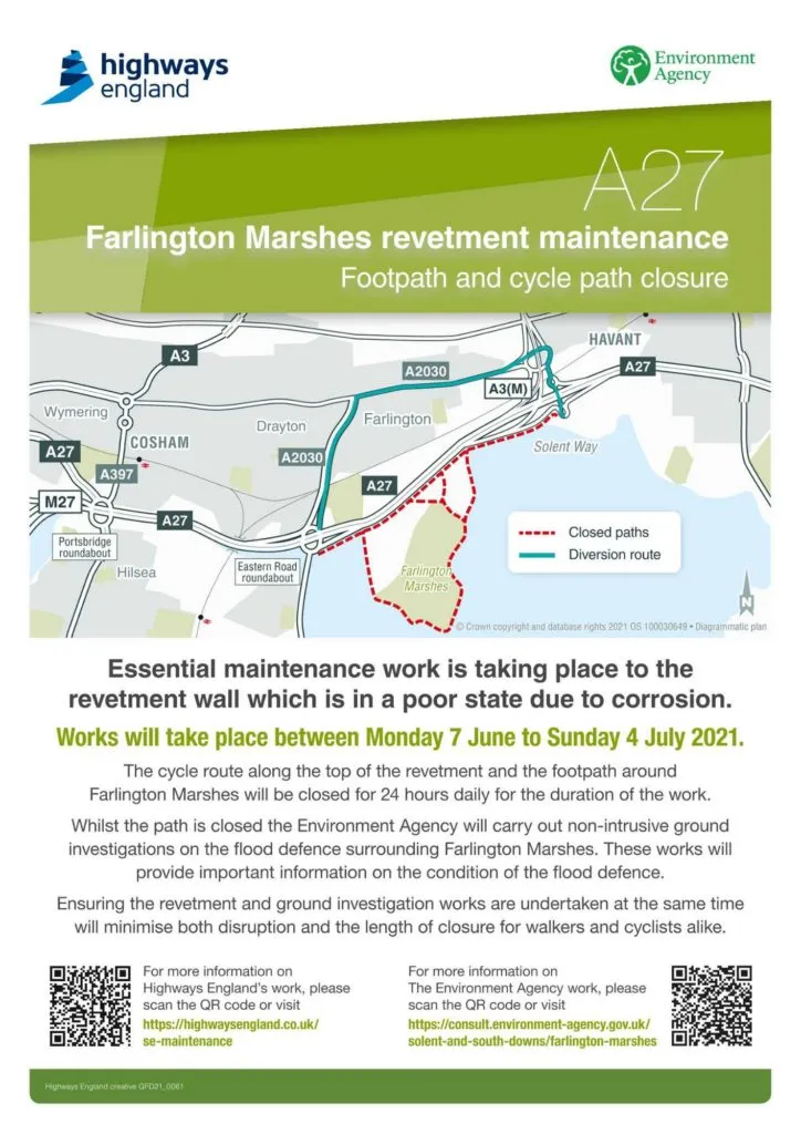
The image shows a simple schematic map of the proposed diversion route and provides two links, one to the Highways England website and one to the Environment Agency website. The latter provides no information about the diversion route but does discuss the reasons the work is required. The former - the Highways England website - provides no information at all about this scheme as of Sunday 16th May 2021. Hence, the only detail on the diversion publicly available is the simple schematic map in this advert.
In order to provide comments on the diversion the route was ridden by a Portsmouth Cycle Forum committee member on Sunday 16th May 2021.
Overall Comments on the Closure and Diversion
The Farlington Marshes cycle route is traffic free, about 2.7km long and takes around 7 minutes to cycle from end to end at a relaxed pace. The route is accessible, safe and attractive to most cyclists - it is safe for inexperienced cyclists, less confident cyclists and families although we note that there are several gateways and bollards that may limit its use to users of adapted bikes and trikes. Although the route is not compliant with LTN 1 / 20 it represents the most attractive route from Portsmouth eastwards and as such is heavily used with an annually averaged usage of around 600 cycle trips per day. This figure will be considerably higher in Summer.
When test-ridden on Sunday 16th May the proposed diversion measured 4.2km East-West and 4.4km West-East. Both directions took about 21 minutes for a confident cyclist at a relaxed pace. In both cases around 6 minutes in total was spent stationary waiting at various crossing points - usually in areas of exceedingly poor air quality.
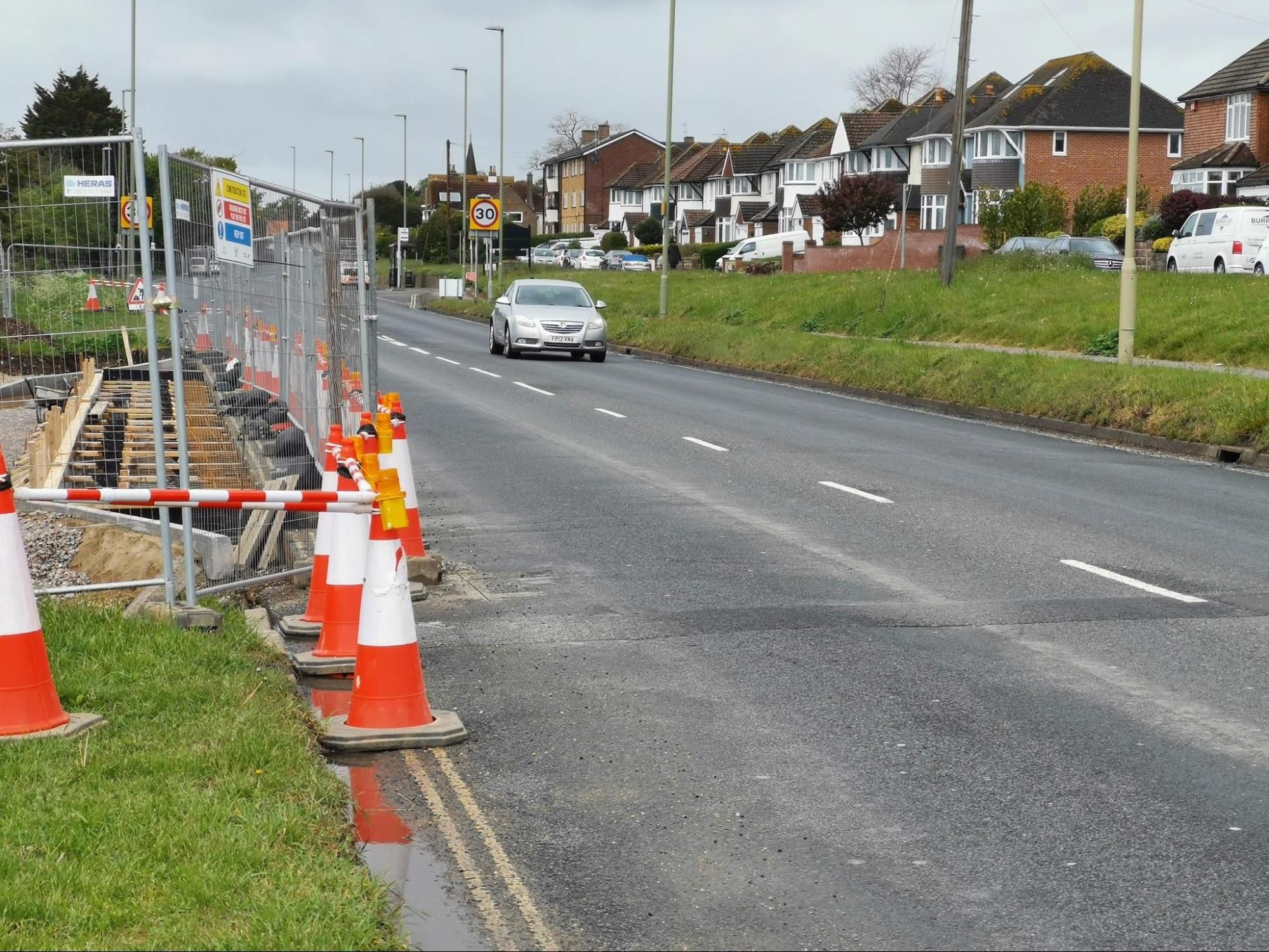
The East-West route involved 20 carriageway crossings, several having no traffic signal control with traffic at or accelerating to national speed limit. A significant section of this route is on road with no marked (let alone protected) space for cyclists with traffic limited to a nominal 40mph (surveys show 85% of traffic exceeds this limit at this point). The limited carriageway space is further reduced by work on a new housing development at Forty Acres Farm.
The West-East route involved 19 carriageway crossings, again several having no traffic signal control with traffic at or accelerating to national speed limit. The on road section is marginally better, having a painted Advisory Cycle Lane (ACL) in parts. However, this disappears in areas where the road narrows and is frequently encroached by moving and stationary vehicles. There are also significant surface issues with sunken ironworks in this ACL.
In summary the diversions, although less than double the distance, take roughly three times as long to cover. They are unattractive, feel hazardous and are thus likely only to be used by experienced and confident cyclists. They are not viable routes for families or for less confident cyclists due to the many difficult and dangerous crossing points and the use of a narrow, fast A-road for a significant part of the route. The route was unpleasant to use on a Sunday morning and will be considerably worse on a weekday.
As the country comes out of lockdown and people return to work this will put people off of trying cycling at the time of year when it is most attractive. The Farlington Marshes route is used by commuters as well as leisure cyclists and it is likely that these commuters will choose to drive instead, adding to congestion and pollution.
We consider this diversion to be unacceptable; being both dangerous and unpleasant. The many hazards and choke-points mean it is wholly unsuited to both the volume and variety of users the Farlington Marshes path attracts. We would like to ask the following questions:
- What risk assessment has been done of the proposed route and can a copy please be provided to Portsmouth Cycle Forum?
- Will any mitigations to any of the problems identified in this document be put in place? E.g. temporary traffic signals at crossing points; temporary cycle lanes on Havant Road; changes to light phasing to speed up crossings?
- When will a detailed map of the route be available?
Detailed Comments on the East-West Diversion
| Location | Comments |
|---|---|
| A3M / A27 Junction | To cross to the shared use path on the East of the A27 (south of Bedhampton Roundabout) involves four uncontrolled crossings. The first of these is a slip road feeding the A3M (Westbound) which is fed by traffic accelerating from the interchange. It is often difficult to judge if vehicles are heading into the slip road or not due to lack of indication and poor lane discipline. The three crossings of the A27 are safer as lanes are controlled by islands, however the final hop is also across traffic accelerating onto a trunk road - in this case the Eastbound A27. |
| Bedhampton Roundabout | To negotiate Bedhampton roundabout the cyclist must first cross the Bedhampton Hill exit, a two step crossing with a central island and no signals to control traffic. Next the cyclist must cross the slip road joining the roundabout from the A3. This is traffic light controlled, however no signal is provided for cyclists or pedestrians and there is no way to see the state of the light facing traffic so non-motorised users are forced to guess. Cyclists then pass under the A3 on an extremely narrow shared use path, which is intended to support cycling and walking in both directions but is not wide enough for users to pass each other comfortably or safely. The final step is to cross the northbound slip road onto the A3M. This is particularly nasty as traffic is accelerating and it is very difficult to assess if vehicles are joining the slip-road or remaining on the roundabout. Even on a Sunday morning traffic levels are such that it is not viable to wait until the roundabout is totally clear, forcing cyclists to take a high-stakes gamble to get across. |
| Entering Havant Road | The cycle route from Bedhampton roundabout to Havant Road has poor sight lines on the corner and is considerably encroached by greenery, increasing the risk of collision between Eastbound and Westbound cyclists. There is then a junction where a side road is crossed and recrossed (Glebe Park Ave / Portsea View). This is a rat-run on weekdays and so a hazard from speeding traffic can be expected. |
There follows a short interlude of off-road path on Havant Road before it must be crossed (via an Island). This crossing is uncontrolled and the speed limit is nominally 40mph but many vehicles exceed that. | | Havant Road - Forty Acres Farm Housing Development | Once on Havant Road Eastbound there is no space allocation for cyclists at all. Whilst still in the nominal 40mph section there is development work at the Forty Acres site. The entry points to this site encroach into the carriageway and force cyclists to move out into the fast-flowing traffic. The left side of the carriageway is heavily damaged in places. | | Havant Road - Near St Andrews Church | The road narrows at this point and traffic is unable to safely pass a cyclist. Thankfully the surface is good but in the test ride it was found that traffic was unable to pass and forced to wait impatiently behind the cyclist. This is a stressful experience. In the evening low sun will make this particularly dangerous for cyclists who may be struck from behind by dazzled drivers. | | Havant Road / Eastern Road Junction | There is no dropped kerb on Havant Road meaning cyclists need to turn left before using the dropped kerb on Eastern Road. Achieving a safe angle of entry to the dropped kerb forces cyclists to swing wide potentially into conflict with traffic. | | Eastern Road to Fitzherbert Road | Narrow shared use path which brings cyclists into conflict with other users. Heavy traffic makes a bell ineffective. | | Fitzherbert Road Junction | Time consuming crossing using three independently controlled toucan crossings. | | Fitzherbert Road to Portsbridge Roundabout | Narrow shared use path which brings cyclists into conflict with other users. The petrol station slip road is a particular hazard as cyclists travelling downhill are expected to give way to traffic approaching them from behind before the oblique crossing. | | Portsbridge Roundabout | To cross to the Farlington Marshes car park involves four separate signal controlled crossings, which is extremely time consuming and encourages risk-taking. Many cyclists choose to risk crossing the exit from the roundabout on to the A3M overpass to reduce waiting time. This unofficial crossing point has no safety features at all and risks collision with traffic accelerating onto the trunk road. |
Detailed Comments on the West-East Diversion
| Location | Comments |
|---|---|
| Portsbridge Roundabout | To cross from the Farlington Marshes car park involves four separate signal controlled crossings, which is extremely time consuming and encourages risk-taking. |
| Exit to Portsbridge Roundabout | The shared use path from Portsbridge Roundabout towards Walton Road is extremely narrow being encroached by bushes. Barely wider than a set of handlebars. |
| Eastern Road / Walton Road Junction | Very long wait for the Toucan crossing encourages risk taking. However, the cyclist is poorly positioned on the narrow approach to have any visibility at all of traffic turning into Walton Road from the A2030. |
| Eastern Road / Grove Road Junction | This junction is traffic light controlled for motorists but the crossing for pedestrians and cyclists is uncontrolled meaning it is necessary to guess when it is safe to cross. This is very difficult as cyclists are positioned with their back to traffic turning left into Grove Road from the A2030. |
| Eastern Road / Havant Road Junction | The shared use path to the West of the A2030 abruptly ends just before Havant Road. There is no crossing point on Havant Road on either side of the junction. It appears cyclists are expected to career off of the shared use path, across a lane of traffic and then turn right on the main carriageway. The alternative is to cross the Eastern Road on foot and use the pavement on Havant Road for about 200 metres to get to a Pelican Crossing. |
| Havant Road | Eastbound on Havant Road an Advisory Cycle Lane (ACL) is provided in parts. However, this disappears in areas where the road narrows and is frequently encroached by moving and stationary vehicles. There are also significant surface issues with sunken ironworks in this ACL. |
| Havant Road / Bedhampton Roundabout Link | Cyclists must cross and recross Portsea View / Glebe Park Ave. This is a rat-run on weekdays and so a hazard from speeding traffic can be expected. The cycle route to Bedhampton roundabout has poor sight lines on the corner and is considerably encroached by greenery, increasing the risk of collision between Eastbound and Westbound cyclists. |
| Bedhampton Roundabout | This is the reverse of the East-West route. First the cyclist must navigate the uncontrolled accelerating traffic leaving the roundabout onto the northbound A3M slip road which is genuinely terrifying. There follows the narrow shared use path before the hidden-signal controlled junction on the A3M off-ramp. There follow two uncontrolled carriageway crossings of Bedhampton Hill. |
| A3M / A27 Interchange. | Four uncontrolled crossings of the A27 and A3M slip road to access the eastern end of Farlington Marshes. Sight lines are better in this direction but crossing can be time consuming due to the volume of fast-moving traffic which may encourage risk taking. |